English Across the Curriculum
Discover India
Physical Geography and Landscapes
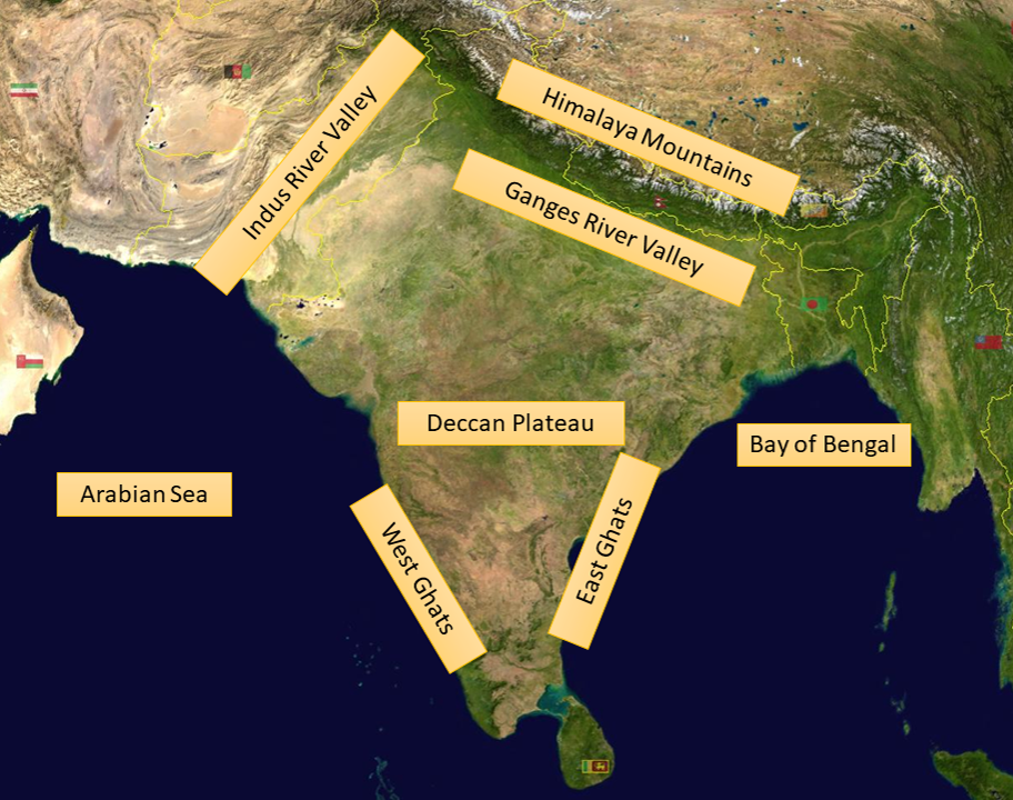
India is a peninsula that extends into the Indian Ocean. It is bordered in the west by the Arabian Sea and Pakistan and in the east by Myanmar, Bangladesh and the Bay of Bengal. In the north it has a common border with Bhutan, Nepal and China.
India got its present form millions of years ago when it started to drift away from the southern continent of Gondwana. After travelling northwards it collided with the Asia . During this period the world’s tallest mountains, the Himalayas, were formed. This process is still continuing as the Himalayas are getting higher and higher.
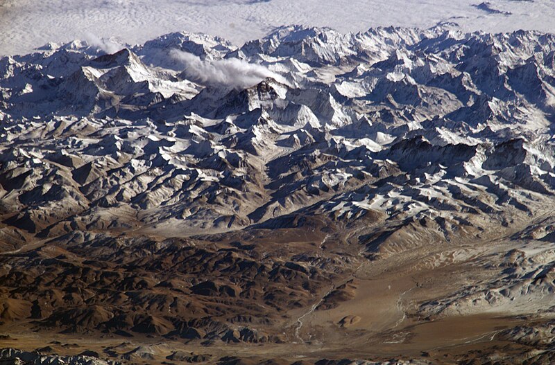
The Himalayan Mountain Range from the International Space Station
Image : NASA, Public domain, via Wikimedia Commons
This gigantic mountain system stretches across Asia for almost 2,200 kilometers. Several parallel ranges of mountains are divided by river valleys. 14 peaks have a height of over 8,000 meters.
South of the Himalayan Mountains lie vast plains which were created by the Indus River in the west and the Ganges River in the east. They extend across northern India for about 2000 km and are up to 300 km wide. The region is not only the heart of India’s fertile farming land but also the most densely populated region of the country. The Ganges is India’s most important river. The sacred river of Hinduism starts out in the Himalayan Mountains and winds its way to Calcutta, where it flows into the Bay of Bengal.
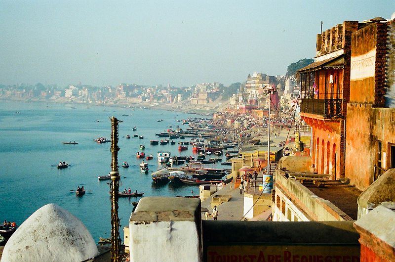
Boats on the Ganges River at Varanasi
Image: Jeeheon Cho from Surat Thani, Thailand, CC BY 2.0,
via Wikimedia Commons
The southern part of India is formed mostly by the Deccan plateau. This geologically oldest part of India lies, on average, a thousand meters above sea level. The plateau is bordered by two mountain ranges: the Western Ghats rise along the Arabian Sea and the Eastern Ghats are parallel to the Bay of Bengal.
Landscapes of India