Landscapes of Africa
The African continent is made up of plateaus, mountains, ridges and basins with great rivers and depressions in-between. Coastal areas are narrow lowlands.
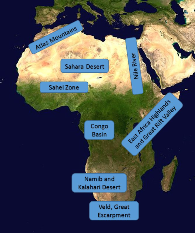
Image : NASA (Public Domain) via Wikipedia
Source : https://en.wikipedia.org/wiki/File:Africa_(satellite_image).jpg
modified by Klaus Rosmanitz
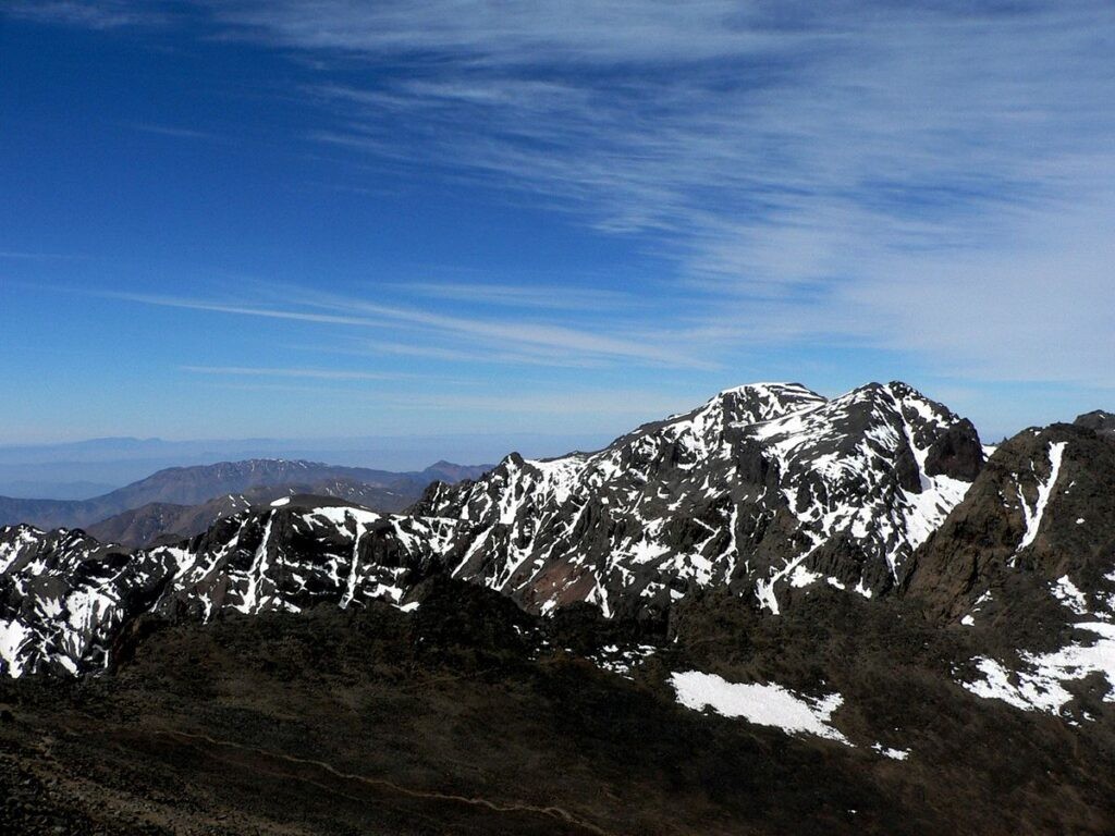
Atlas Mountains
The Atlas Mountains in the north-western part of Africa emerged at the same time as the Alps rose in Europe. The mountain range extends from Morocco to Tunisia, with its highest peaks reaching an altitude of slightly over 4000 metres (13,500 feet)
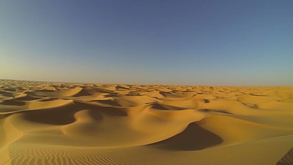
Sahara Desert
The Sahara desert covers a third of the African continent. It reaches from the Atlantic Coast to the Red Sea. With a total area of 9 million square kilometres, the Sahara is the greatest desert in the world. It is made up of rocky and sandy plains with isolated mountains rising from them. Small rivers flow from southern slope of the Atlas Mountains into the desert and irrigate isolated oases. Towards the south the desert merges with patches of short grass and bushes that extend from coast to coast. The Sahel region, which lies between the Sahara and the tropical rainforest, receives little and irregular rainfall. If it does not rain at all, droughts spread throughout the region and it gets too dry for cattle and other animals. Millions of people have died from starvation in the past decades.
|
Atlas mountains in Marocco |
Sahara desert in Algeria |
The Nile River
In the eastern part of the Sahara desert, the Nile River winds its way to the Mediterranean Sea. The longest river system in the world begins near the equator in the highlands of Eastern Africa and flows through many different landscapes.
East African Highlands
East Africa is dominated by highlands and plateaus, as well as lakes and deep mountain valleys. They stretch from Ethiopia in the north to Mozambique in the south. Most of the highlands reach heights of over 1,500 metres. The highest mountains are old volcanoes that are not active any more. Mount Kilimanjaro, situated near the equator, is almost 6,000 metres high.
The Great Rift Valley is a series of cracks in the Earth’s surface that extends from The Red Sea to Mozambique. It was created when the African continent broke apart millions of years ago. The area once was dominated by active volcanoes and earthquakes. Today, the Great Rift Valley is made up of deep and narrow lakes. Lake Tanganyika, which is over 400 miles long and 1500 metres deep, is the longest freshwater lake in the world. The largest African lake, Lake Victoria, lies is a shallow basin between two deep valleys.
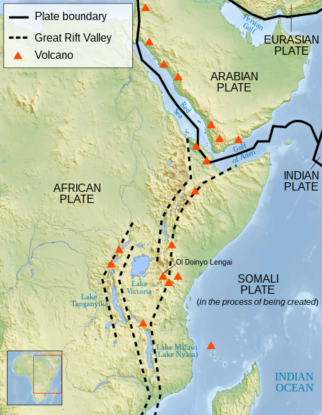
Great Rift Valley
Image: Sémhur, CC BY-SA 4.0, via Wikimedia Commons
Congo River Basin
The Congo River with its gigantic basin takes up much of central Africa. It stretches from the Atlantic to the highlands of East Africa and makes up about 20% of the world’s rainforests. Except for the Amazon, it carries more water than any other river in the world. The rainforest is habitat of half of the Africa’s plants and wildlife.
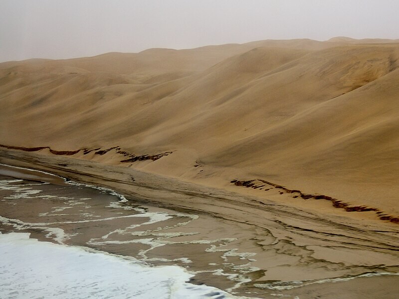
Deserts in Southern Africa
Southern Africa is covered by large deserts. The Namib Desert is the oldest in the world. It stretches along the Southern Atlantic coast of the continent and reaches up to 200 km inland. Its sand dunes near the coast reach a height of 300 metres and are up to 30 km long.
The Kalahari Desert is a dry sand basin that covers much of Botswana and western Namibia. It is not a real desert because the area gets at least some rainfall which makes it possible for animals to graze during the wet season.
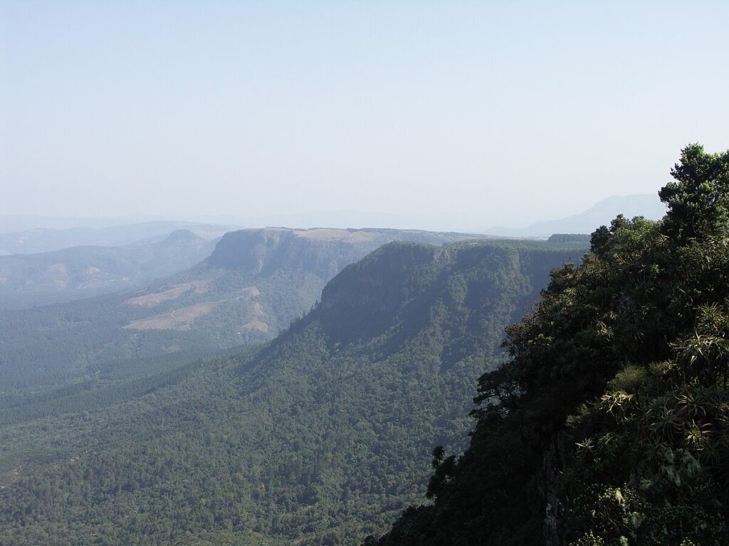
South Africa
Most of South Africa is a series of old plateaus called velds. They reach a height of about 2,500 metres. To the south a ridge called the Great Escarpment drops down to the small coastal strip. Within this escarpment, the Drakensberg rises to an altitude of almost 3,500 metres.
|
Namib Desert and the Atlantic coast |
Great Escarpment |
.jpg)
Islands
Africa is a continent with straight coastlines and therefore very few islands. The largest island, Madagascar, lies almost 400 km east of the mainland. Millions of years ago it was a part of India. It split from the Asian subcontinent and developed its own plant and animal life. Other important island groups are the Canaries in the Atlantic Ocean and the Seychelles and Mauritius in the Indian Ocean.
Words
- altitude = height
- basin = an area of low land that is lower in the centre than at the edges
- carry = here: transport
- cattle = cows
- coastal strip = narrow part of land near the sea
- coastline = where land meets the sea
- crack = very small space between two things
- decade = a period of ten years
- depression = land that is lower than other land around it
- develop = grow, create
- dominate = here: the main action or force
- drought = long period of dry weather , in which there is not enough water for plants and animals
- dune = hill made of sand near the sea or in the desert
- earthquake = a sudden shaking of the Earth’s surface; it happens when plates move
- emerge = here: come out of the sea
- equator = line around the middle of the Earth
- escarpment = a high slope or cliff between two levels on a hill or mountain
- extend = reach from .... to ....
- flow = when water moves down land
- freshwater = water with no salt in it
- gigantic = very big
- graze = an animal eats grass that is growing
- habitat = natural home for plants and animals
- height = how high something is
- inland = away from the coast
- irregular = here: not at the same time every year
- irrigate = to bring water to dry places
- isolated = alone, separated
- mainland = the main part of the continent, without the islands
- Mediterranean Sea = sea between Europe and Africa
- merge = combine, join together
- mountain range = long line of mountain tops
- narrow = not wide
- oasis = place with water and trees in a desert
- patch = area, spot
- peak = the highest part of a mountain
- plains = large area of flat, dry land
- plateau = large area of flat land that is higher than the land around it
- reach = extend from one place to another
- receive = get
- ridge = a long area of high land, at the top of a mountain
- shallow = not deep
- situated = located
- slightly = a little
- slope = side of a hill or mountain
- split = separate
- starvation = hunger
- surface = the top part of an object
- therefore = that is why
- throughout = in all of
- valley = area of lower land between two mountains; in most cases a river flows through it
- wind = turn and twist